
 |
| I stopped alongside the airport and took this amazing shot. Despite the snowy peaks the temperature here was pleasant |
 |
| Over the airport fence |
 |
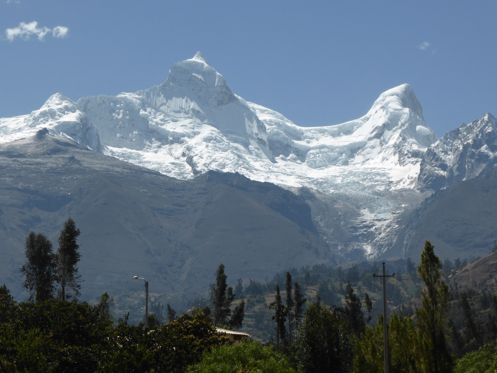
| Huascaran the tallest peak in the Peruvian Andes at 6768 metres (22204 feet!) |
 |
| Agriculture in the river valley |
 |
| Farms lining the riverbanks |
 |
| Panorama |
 |
| Hydroelectric plant along the river |
 |
| More of the hydroelectric plant |
 |
| From a distance it looked pretty harmless |
 |
| Warning sign at the beginning that it is now a dirt road |
 |
| Steep drop to Rio Santa |
 |
| ... with evidence of erosion |
 |
| The road was only wide enough for one vehicle at a time, but there were pull-off places |
 |
| The first of the 35 one-way tunnels |
 |
| The tunnels were pretty scary on two wheels - no room to pass, going from bright sunlight into total darkness, despite the headlight, and nowhere to go if something approached from the other side |
 |
| The road surface was made up of tiny pebbles, like pea shingle, and despite the dirt tyres my bike was skittering about a little |
 |
| Looking back the way I had come, showing the steep sides of the canyon |
 |
| ... and the road ahead! |
 |
| Wooden single track bridge near the start of the Cañón del Pato |
After a couple of kilometers I decided that discretion was the better part of valour, and that I should turn back. The road surface was "slippery", the road itself very narrow, the tunnels scary, and I had already met a few vehicles coming towards me, and if I did make it I would have 15 kms back along it (or a much longer detour along dirt roads) to get back. At least I get to brag that I have been on one of "the world's most dangerous roads"!
Retracing my steps back along the main road I was now looking for somewhere to have a bite to eat and found a bakery in Yungay, where I had a pasty and a pastry, and consulted my map. The young lady in the bakery was fascinated by this Gringo biking alone in a remote part of Peru, and was interested in where I was from, and what led me to being in Peru - so I passed my meal chatting with her until customers arrived.
I had read about a mountain lake at the base of Huascaran, Peru's tallest peak, so decided to head for there, and was, in fact, very close to the start of the road - another dirt road! But with the glorious sight of Huascaran in front of me the road was immaterial.
 |
| Some of the peaks in the Cordillera range |
 |
| Huascaran in front of me |
 |
| I was heading for a lake at the base of the left mountain |
 |
| I was following a car up the winding dirt road and so as not to eat his dust (I was quicker on the twisty bits but not on the straight ones!) I fell back and stopped to take pictures - this of a farm on the foothills of Huascaran. |
 |
| All that remained of the avalanche was what looked like smoke at the lower edge of the snow |
 |
| Climbing higher the vegetation thinned out, but there were still signs of agriculture |
 |
| At times here you do feel as though you are on top of the world |
 |
| The approach to the lakes passed through this steep-sided pass |
 |
| Hard to tell, but I believe the cliffs to be around 2000 metres high! |
 |
| I finally arrived at Laguna de Llanganuco, some 3850 metres above sea level (12600 feet) |
 |
| Boat trips across the crystal waters are popular |
 |
| Huascaran towering over the surrounding area |
 |
| Lonely llama - I think he was there for selfies with the visitors - there were a couple of busloads there while I was visiting |
 |
| Incredible beauty |
 |
| Tourist centre - with toilets and places to eat |
 |
| Peeling bark on a mountain tree |
 |
| Some of the boats were being painted |
 |
| Llanganuco is one of a chain of lakes running between the mountains |
 |
| Although there were other people about it felt as though I had the place to myself |
 |
| Spectacular - and so tranquil |
 |
| The surrounding mountainsides looked forbidding |
 |
| Llama foraging |
 |
| Another of the tall peaks |
 |
| Idyllic scene |
 |
| Lovely place for a selfie, so ... |
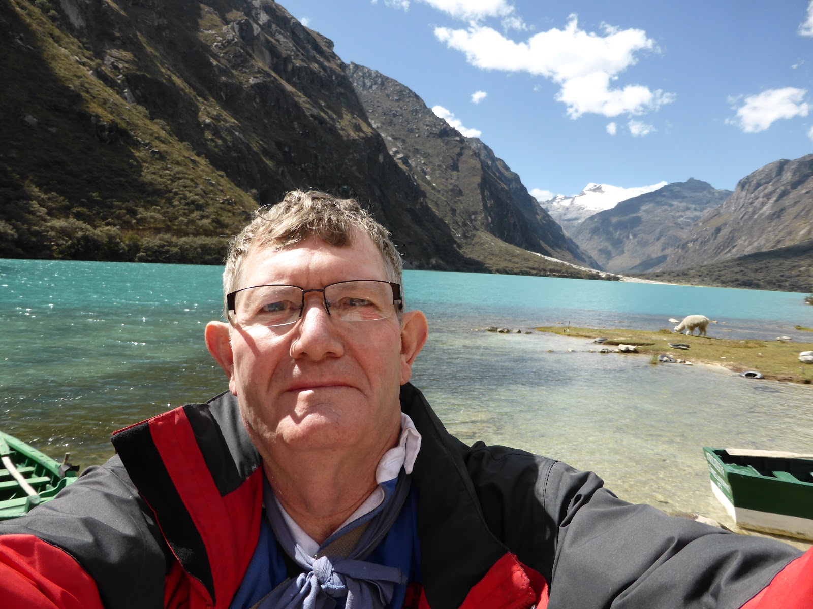 |
| ... rare picture of me! |
 |
| Huascaran |
 |
| On the way back - the deep pass we had to go through |
 |
| The view to the West of the Cordillera |
 |
| Oli - dwarfed by the mountains |
 |
| Huashao - small town in the shadow of Huascaran |
 |
| imagine waking to that every morning! |
 |
| Looking along the Cordillera Blanca |
 |
| Coloured sweetcorn drying in the sun |
 |
| I had to keep stopping to take in the beauty of this area |
 |
| Looking back down towards Yungay |
 |
| Campo Santo, Yungay, memorial to the 20,000 killed in the 1970 earthquake. |
Arriving at the hostel I asked for the keys to take my bike to the secure parking at the rear, but was convinced that it was easier (for them, maybe?) to take it inside the hostel - which meant using a makeshift ramp to get it over the small retaining wall at the kerbside, and manhandling it - with three members of staff assisting - through the front door and into a small courtyard at the rear. We then had to go to the parking anyway to collect my detachable panniers and bring them round as well.
No comments:
Post a Comment
Please feel free to leave your comments, however Spam or adverts will not be allowed. The blog is open to all so please minimise the use of improper language!