Huaraz is the main city in the Cordillera Blanca and a very popular tourist destination, and I was informed that many mountaineers use the peaks in the area as training for trips to the Himalayas and Mount Everest!
 |
| Huanchaco to Huaraz |
As is the case when travelling almost anywhere from Huanchaco I had to start on the Panamerican Highway! The highway by-passes Trujillo, but to the South passes through an industrial area, so is very busy for the first 20 kms or so, but then returns to being the same boring highway - miles of sand hills and nothing much else to see. The first 200 kms of the 350 km trip was like this - mind-numbingly boring, but once you turn away from the coastal highway and start climbing the scenery become much more interesting.
 |
| Still not very pretty close to the road ... |
 |
| ... but the distant mountains looking very appealing |
 |
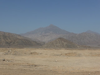
| This is typical scenery all along the Panamerican Highway through the coastal desert! |
 |
| My route was taking me higher |
 |
| Decent road surface |
 |
| Beautiful mountain streams along the way |
 |
| Looking down on one of the small towns I passed through |
 |
| Fields laid out on the mountainsides |
 |
| First sight of the snowcaps |
 |
| High peaks of the Cordillera Blanca |
 |
| My first snow in South America |
 |
| Soon Huaraz appeared nestled beneath the mighty snowy peaks |
 |
| Huaraz |
 |
| Huaraz Panorama - showing the hairpins I still had to navigate. |
 |
| Although nestled in a valley, surrounded by mountains, Huaraz is still 3000 metres above sea level! |
 |
| Looking Southwards |
As already mentioned the road down into Huaraz is steep and twisty, but fortunately my hotel was not that far from where the road arrives in Huaraz, and I found it very quickly. The parking, however, was not on site, but in a locked area in the next street, so after unloading and being showed to my room someone walked me round to leave Oli.
I had booked a single en-suite room but the one they showed me had 4 beds in it, though I did have it to myself the whole length of my stay, and the tariff behind the reception desk showed the price as around 5 times what I had been quoted (and had the booking form to prove it!) on Booking.com, so I was a little concerned about what would happen on checkout when I came to pay, but my concerns were unfounded and I was charged the booking price.
As I unpacked I found that I had left the charger for my Netbook behind, so headed out to see if I could find something suitable - but like an idiot did not take the Netbook with me, so it took two trips! The short walk to the electrical store had left me a little breathless, as I had expected at that altitude, but I still felt fine so after a short rest and taking a picture of the sunset from my window (not a great view from it) I went for a short walk again and some dinner before turning in for the night.
 |
| Sunset over Huaraz |

No comments:
Post a Comment
Please feel free to leave your comments, however Spam or adverts will not be allowed. The blog is open to all so please minimise the use of improper language!