So it was with some delight that shortly after leaving Piura I found myself on a newly constructed section of fine dual carriageway, though this was fairly short-lived, and soon I was in the town of Sullana. The highway runs right through the middle so should not be an issue, but at the far end, just before the river Chira, you go round a roundabout and there are two exits side by side - one, the main road, heads into a tunnel, which has a "no motorbikes" sign, so I take the right exit and see the main road alongside me disappear into the tunnel, so keep going. As always there are no more road signs so I just keep going straight, hopefully following the route of the main road, and soon see the river to my left, and the main bridge crossing running alongside my route! I can see a smaller bridge some way ahead so keep going, and take this bridge, even though there are still no road signs, and keep going forwards - eventually with no warning we meet another road, with just a small "give way" sign at the opposite side of the road. I assume that I am back on the Panamerican Highway, but then notice I am on a road running parallel to it, with no sign of any links to it! So I turn back and eventually ride through a petrol station which straddles the two road, and am back on my way!
The countryside I am going through now is quite lush vegetation, so a very pleasant change from the coastal desert I had ridden through yesterday, and at first traffic is quite a lot heavier as it appears to be a populated area, so I have to keep my wits about me as there is a proliferation of three-wheelers, though they are pretty good at riding on the hard shoulder leaving the carriageway clear. Though as I leave Sullana district behind the vegetation turns to, I think, rice fields, and traffic becomes sparser.
 |
| I passed this huge (for Peru) water park, though there was no-one there |
 |
| At first these mountains could be seen in the distance |
 |
| More sand! |
 |
| Featureless landscape |
 |
| Though there were still some hills on the horizon |
Sights like this, a canyon created by rainwater run-off from the Northern Andes, helped to break the monotony
 |
| Deep ravines carved by rainwater |
 |
| The road ran along the ridge |
 |
| The riverbed dry for most of the year |
 |
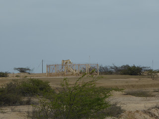
| Pumpjack |
 |
| I understand that some of these pump oil and others gas |
I knew that the hostel I was booked in was a little way outside Zorritos, but the address just said KM582 Panamerica Norte, and kilometre posts were in short supply, and in fact I rode straight past it initially - the sign was angled such that it was not very visible from the road! When I reached Zorritos I realised I had gone too far so turned back, and managed to find it at the second attempt!
 |
| My bungalow at Zorritos |
 |
| Map of my route from Piura to Zorritos |
Then I headed back to the hostel for a siesta - having covered another 250 kms that day.

No comments:
Post a Comment
Please feel free to leave your comments, however Spam or adverts will not be allowed. The blog is open to all so please minimise the use of improper language!